


Voting District 50000, Kern County, California
About
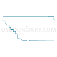
Outline

Summary
| Unique Area Identifier | 531590 |
| Name | Voting District 50000 |
| County | Kern County |
| State | California |
| Area (square miles) | 1.86 |
| Land Area (square miles) | 1.86 |
| Water Area (square miles) | 0.00 |
| % of Land Area | 100.00 |
| % of Water Area | 0.00 |
| Latitude of the Internal Point | 35.37654280 |
| Longtitude of the Internal Point | -118.99072500 |
Maps


Graphs
Select a template below for downloading or customizing gragh for Voting District 50000, Kern County, California


Neighbors
Neighoring Voting District (by Name) Neighboring Voting District on the Map
- Voting District 30390, Kern County, CA
- Voting District 30445, Kern County, CA
- Voting District 50005, Kern County, CA
- Voting District 50010, Kern County, CA
- Voting District 50015, Kern County, CA
- Voting District 50120, Kern County, CA
- Voting District 50130, Kern County, CA
- Voting District 50135, Kern County, CA
- Voting District 50145, Kern County, CA
- Voting District 50150, Kern County, CA
- Voting District 50151, Kern County, CA
- Voting District 50555, Kern County, CA
- Voting District 50560, Kern County, CA
- Voting District 50940, Kern County, CA
Top 10 Neighboring County Subdivision (by Population) Neighboring County Subdivision on the Map
Top 10 Neighboring Place (by Population) Neighboring Place on the Map
Top 10 Neighboring Elementary School District (by Population) Neighboring Elementary School District on the Map
Top 10 Neighboring Secondary School District (by Population) Neighboring Secondary School District on the Map
Top 10 Neighboring State Legislative District Lower Chamber (by Population) Neighboring State Legislative District Lower Chamber on the Map
Top 10 Neighboring State Legislative District Upper Chamber (by Population) Neighboring State Legislative District Upper Chamber on the Map
Top 10 Neighboring 111th Congressional District (by Population) Neighboring 111th Congressional District on the Map
Top 10 Neighboring Census Tract (by Population) Neighboring Census Tract on the Map
- Census Tract 14, Kern County, CA (7,766)
- Census Tract 13, Kern County, CA (7,559)
- Census Tract 20, Kern County, CA (7,111)
- Census Tract 6, Kern County, CA (6,931)
- Census Tract 22, Kern County, CA (6,537)
- Census Tract 12.02, Kern County, CA (6,264)
- Census Tract 7, Kern County, CA (4,825)
- Census Tract 21, Kern County, CA (3,852)
- Census Tract 23.02, Kern County, CA (3,378)
- Census Tract 15, Kern County, CA (3,147)